Realistic Ionosphere (RI)
PIs: Dr. Bodo Reinisch and Dr. Ivan Galkin (U of Massachusetts Lowell) United States
The Realistic Ionosphere (ReI) provides accurate and prompt nowcast of the 3D global plasma density distribution in the subpeak ionosphere. It includes several sensing, modeling, and computer science components:
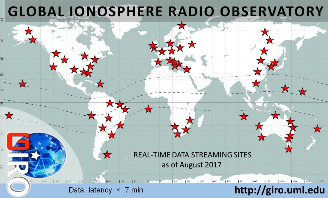
![]() GIRO: Global Ionosphere Radio Observatory [1]
GIRO: Global Ionosphere Radio Observatory [1]
A multi-nation coordinated network of ionosondes providing near-real-time
(nRT) low-latency measured data of the subpeak ionospheric plasma density,
including raw and derived data products:

- vertical and oblique ionogram data and displays,
- ionogram-derived autoscaled and validated records of electron density profiles, and standard URSI characteristics (foF2, hmF2, etc.),
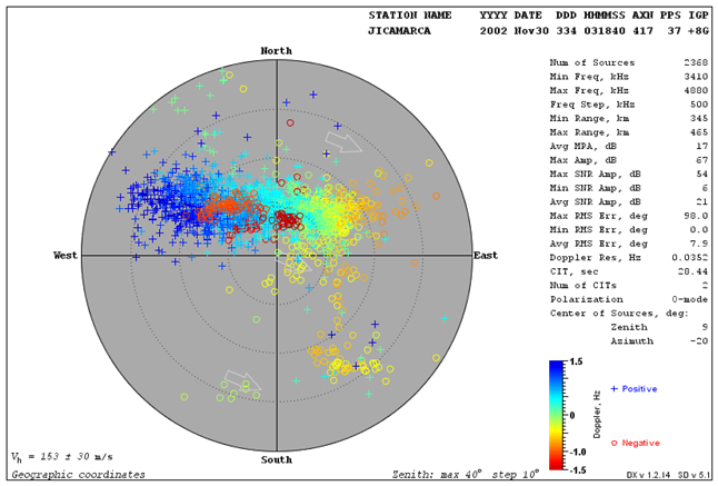
- skymaps of signal propagation,
- plasma drift bulk velocities,
- local tilts of the ionosphere, and
- measurements of Traveling Ionospheric Disturbances (TIDs).
Open Data Portal: giro.uml.edu
![]() IRTAM 3D: IRI-based Real Time Assimilative Model [2]
IRTAM 3D: IRI-based Real Time Assimilative Model [2]
A global 3D empirical nowcast of the ionospheric plasma density based on a Real-Time IRI technique
of smooth transformation of the background International Reference Ionosphere (IRI) climatological
model into the optimal match with GIRO measurements. The IRTAM 3D updates are issued every 15 minutes
with a 7.5 minute latency from the GIRO start of ionogram measurements.
Latest 24-hours of IRTAM Ionosphere: 24-hour animated global maps
Retrospective IRTAM database: GAMBIT Consortium and open source GAMBIT-X.
| foF2 | hmF2 | B0 | B1 |
 | |||
![]() TID Explorer (TIDx) [3,4]
TID Explorer (TIDx) [3,4]
Based on Doppler-Frequency-Angular Sounding (FAS) sensing method [5] between two Digisonde DPS4D
instruments, TID Explorer provides nowcast and forecast of traveling ionospheric disturbances:
natural or artificial phenomena associated with the wave-like perturbation of plasma density in
response to propagation of the acoustic gravity waves in the neutral atmosphere. The FAS method
allows full specification of the TID ensemble, including its amplitude, period, and the K vector of propagation.
Pilot TID Warning system is operational at tid.space.noa.gr based on the network of DPS4D observatories in Europe.

![]() Sky-LITE: Skymapping for Local Ionosphere Tilt Evaluation [5]
Sky-LITE: Skymapping for Local Ionosphere Tilt Evaluation [5]
Use of HF skymapping technology for a wide-angle sensing of the ionospheric plasma structures to
determine local tilts of isodensity surfaces in the ionosphere.
![]() RayTRIX: Ray-Tracing through Realistic Ionosphere eXplorer [6]
RayTRIX: Ray-Tracing through Realistic Ionosphere eXplorer [6]
Signal raytracing through the ionospheric channel specified by IRTAM, Sky-LITE and TIDx.
![]() LGDC: Lowell GIRO Data Center
LGDC: Lowell GIRO Data Center
A collection of computer software, database engines, and computer infrastructure
for computations associated with ReI nowcast and warning services, and open international
data access for academia, students, radio enthusiasts, and space weather applications.
Over 600 million records of sounding data available over GIRO Web Portal.
Online interactive data explorer workstations with capability to submit derived
and annotation value-added information to LGDC.
Data Access
GIRO Web Portal with Open Data policy and Rules of the Road.
References
- Reinisch, B. W., and I. A. Galkin. Global ionospheric radio observatory (GIRO), EPS, 63, 377-381, doi:10.5047/eps.2011.03.001, 2011.
- Galkin, I.A., B.W. Reinisch, X. Huang, and D. Bilitza. Assimilation of GIRO Data into a Real-Time IRI Radio Science, 47, RS0L07, doi:10.1029/2011RS004952, 2012.
- Reinisch, B.W., I.A. Galkin, A. Belehaki, et al. Pilot ionosonde network for identification of travelling ionospheric disturbances, submitted to Radio Science (2017).
- Verhulst, T., D. Altadill, J. Mielich, B. Reinisch, I. Galkin, A. Mouzakis, A. Belehaki, D. Buresova, S. Stankov, E. Blanch, D. Kouba. Vertical and oblique HF sounding with a network of synchronised ionosondes, Adv. Space Res., doi:10.1016/j.asr.2017.06.033, 2017.
- Paznukhov, V.V., V.G. Galushko, and B.W. Reinisch. Digisonde observations of TIDs with frequency and angular sounding technique, Adv. Space. Res., 49(4), 700-710, doi:10.1016/j.asr.2011.11.012, 2012.
- Huang, X. and B.W. Reinisch. Real time HF raytracing through a tilted ionosphere, Radio Sci., 41(5), RS5S47, doi:10.1029/2005RS003378, 2006.